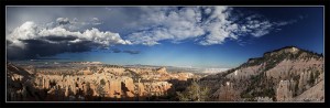
Bryce Canyon actually isn’t a canyon. A canyon is supposed to be a deep gorge between two cliffs. You’ll often see a river flowing through it. The river is a major factor for the erosion and carving of the canyon. Bryce Canyon is different – no gorge, no river. It’s located at the border of a highland plateau and lowlands. Erosion over the centuries has carved out large amphitheaters, or bowls, at the edge of the plateau. The hoodoos are remnants of the plateau that are still trying to resist the erosion. Over time, the hoodoos will fall apart.
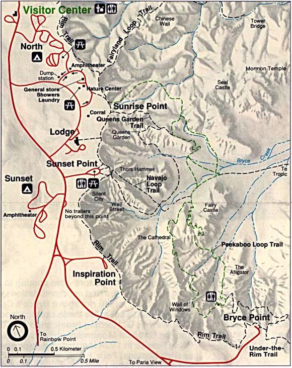
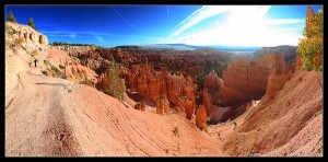
The park is pretty easy to get around. There is one road (~20 miles) that takes you north/south, along the edge of the plateau. There are many viewpoints to stop at. There are many hiking trails that start at the viewpoints too. One challenge with hiking, however, is elevation. Most of the trails involve going down into the amphitheaters and returning up to the plateau. You could have a good time at Bryce Canyon just driving up to the viewpoints and skipping the hikes. But being able to do some hikes makes the experience even better.
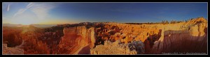
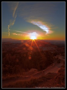
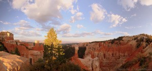
By far, the best time to see anything at Bryce Canyon is in the early morning. Since the plateau goes north/south, the rock amphitheaters are all located east of the plateau. The morning sun rises behind the park, and it shines with brilliance directly on the rock. I am no morning person, but I made it up to catch a sunrise at Bryce Canyon. It was amazing.
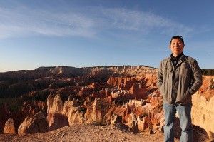
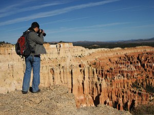
There’s actually a viewpoint at Bryce Canyon called Sunrise Point – what a convenient name! We headed there and caught the sunrise. What I learned, however, was that if you hiked a little bit on the Queen’s Garden Trail, you could get a better view of Bryce Amphitheater. There are several rock amphitheaters at the park; Bryce Amphitheater is the most well-known. In the photo above right, I climbed up a rock column along this trail. It was a great place to enjoy the morning sunlight (make sure you bring a coffee).
Navajo Loop Trail and Thor’s Hammer
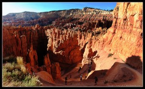
If you could only do one hike in Bryce Canyon, it should be the Navajo Loop Trail. It’s a short trail of only 1.3 miles, but the 500 foot elevation change and switchback trails can make it a challenge if you aren’t in good shape. It’s a circular trail, starting at Sunset Point, which is near the center of the park. The trail takes you past three of the most well-known rock formations at the park: the Silent City (above right), Wall Street (below right), and Thor’s Hammer (below center). The Silent City is a formation of tightly-packed hoodoos. Wall Street is a fin – long and narrow.
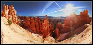
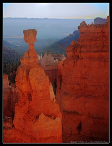
Yellowstone has Old Faithful. Arches has Delicate Arch. The equivalent superstar feature for Bryce Canyon is Thor’s Hammer. It’s a super cool hoodoo. The base of Thor’s Hammer is rock column that stands alone, in the middle of a small valley. The “hammer” is a rock that is perfectly balanced on top of the column. I love it!
Just to be clear, you can actually see Thor’s Hammer and the Silent City from Sunset Point, without hiking the trail. But the trail takes you down and up close, which makes the experience more amazing. These photos of Thor’s Hammer we taken from near the bottom of the trail.
Although it’s called Sunset Point, you really shouldn’t go there to see sunsets. Since the highland plateau is on the west side of the park, the evening sun gets blocked. The rock amphitheaters end up in the shade several hours before sunset. On the other hand, Sunset Point and the Navajo Loop Trail would actually be great to see at sunrise! If I could wake up early once more to see a sunrise, I would go here.
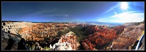
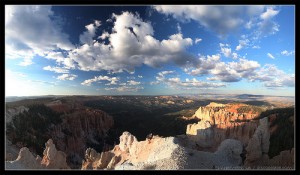
Throughout most of Bryce Canyon, the edge of the plateau (and the main road) goes north/south. The only exception is at Bryce Point (photo above), whether the plateau sticks out two miles to the east – kinda like a peninsula. This gives you a great viewpoint of the Bryce Amphiteater, from the east side and looking west. I’m told that Bryce Point is also another great place to see the sun rise. There are some great hiking trails that originate from here (Peekaboo Loop, Under-the-Rim).
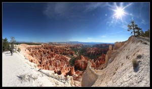
Inspiration Point (above right) is located near the main road, on the way to Bryce Point. You have a great close-up view of the Silent City. You can also wave hello to folks at Bryce Point.
The Rest of Bryce Canyon
Bryce Canyon’s main road goes for about 20 miles. There are a bunch of other viewpoints, amphitheaters, and trails along this road. Here are some highlights.
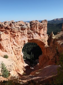
The photo above left is of the Natural Bridge rock formation. Technically, it’s an arch, not a bridge. But who’s counting? 🙂
The photo above right is of Agua Canyon. I didn’t get many good photos with evening light, but this one is pretty decent.
The photo above is from Rainbow Point, which is at the end of the main road. Rainbow Point is the area of highest elevation at Bryce Canyon. It also marks the highest “stair” of the Grand Staircase of the Escalante National Monument (I will explain this in an upcoming blog entry).
Conclusion
I loved Bryce Canyon. It’s a unique park with breathtaking views. I was pretty happy with my two days at Bryce Canyon. If you were short on time, you could easily cover the main attractions in a day. If you like to hike, you could easily spend a few more days here.
Upcoming articles: Zion National Park, Grand Staircase National Monument
Related links:
2 comments on “Bryce Canyon National Park”