It was late Saturday afternoon in Moab. I had just woken up from a peaceful air-conditioned siesta in the hotel, while the sun was bearing down outside with 105F temperatures. Hopefully it had cooled down a tiny bit. Time to head out again and do an evening hike.
The original plan was to go back to Arches National Park. But as I went outside to the car, I noticed that the sky had gotten rather cloudy, just in a few hours. All that heat and humidity builds up weather systems so quickly! I figured that all the clouds would prevent good evening sunlight from shining on the arches. So it was time to head elsewhere. I decided to go west to Dead Horse Point.
Before arriving in Moab, I had never heard of Dead Horse Point State Park. And even if I had heard of the park, why would I go all the way to Utah to visit a state park?? There are all sorts of national parks around, duh! But I spoke to my buddy Rob, who had been here a week ago, and he recommended going there. Taking a look at some pics online, going there surely made sense. It looked spectacular! I guess when you’re in the Great West, even a state park can blow away anything you see in the flat, corn-filled midwest.
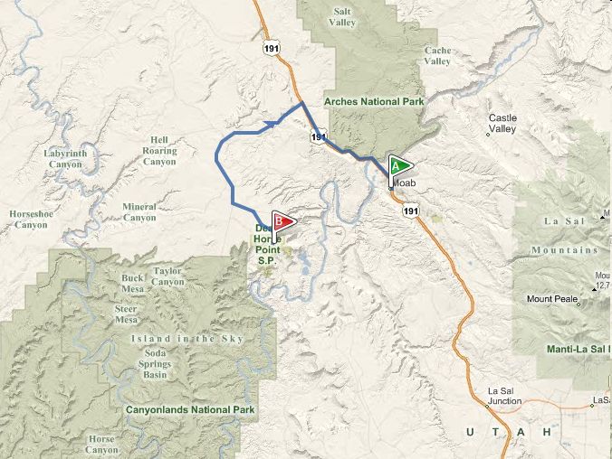
Dead Horse Point State Park is about a 30 mile drive from Moab. It’s right next to Canyonlands National Park. I actually don’t understand why they didn’t make it part of Canyonlands. The scenery/geology is pretty much the same.
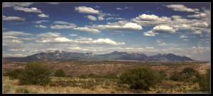
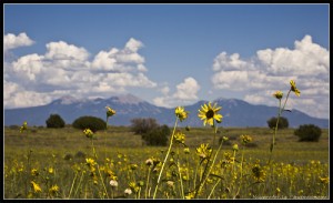
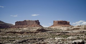
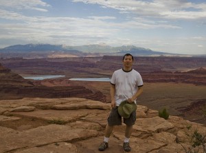
The drive to Dead Horse / Canyonlands is very scenic. There are viewpoints for you to pull off and take photos or have a picnic. There are some great views of the La Sal Mountains to the east (first two photos below), as well as nearby rock formations like Merrimac and Monitor Buttes (third photo below).
Here’s a more detailed map of the park, from the official park website. The park is pretty small and simple. There’s only one road in the park. The road overlooks canyons on both sides. It ends at Dead Horse Point. Sounds like there are some great hikes, especially if you want to go down into the canyons. But if you are lazy like me and just want to snap photos, there are several great overlooks.

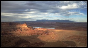
Looking to the east, you can see Pyramid Canyon and the Shafer Basin. The La Sal Mountains are in the distant background. Here are some shots, the first two from the Basin Overlook, and then the Pyramid Overlook.
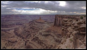
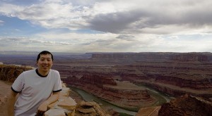
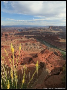
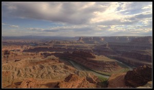
The true gem of the park, as the name suggests, is Dead Horse Point. Dead Horse Point sticks out into the canyon. You get a beautiful panoramic view of the area, which includes the Colorado River curving in a “gooseneck” shape.
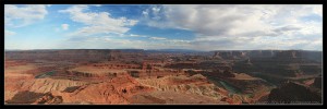
Finally, I leave you with a panorama photo of Dead Horse Point. Click on it to view it in full screen mode.
Check out this article and others from my blog:
– This article
– All articles on Utah 2010 trip
– Slideshow of Utah 2010 trip photos on Flickr
– Blog home